When Monument 78 is unreachable
On the Washington PCT Section L is the most prone to wildfires. Under primarily E/NE winds, the Olympic Mountains, Mount Baker, and the North Cascades all force moisture to fall as rain before Pacific air can reach Section L. So, dry conditions, a fire, and a trail closure is a fairly common event at some point in a given hiking season.
That is an unfortunate fact for hikers with a goal of reaching the US/Canada border at monument 78. A closure that merely forces hikers to rejoin the PCT somewhere north of Harts Pass before hiking toward the border is much less heartbreaking than a closure that prohibits Monument 78 from being a goal at all. Some hikers will choose to come back in the spring to hike Section L. Others committed to reaching Canada will find routes to other points along the border.
Alternate border contacts
There are not many near-PCT options for touching Canada using maintained trails:
East of the PCT
- 7 miles east of the NT - Monument 83 on the peak east of Chuchuwanteen River, via Trail #482. closed 2026 due to the Ptarmigan fire.
- 11 miles east of the NT - Monument 85 on the west side of the Pasayten River, via trail #461 (Monument 85 Trail). closed 2026 due to the Ptarmigan fire.
- 18.5 miles east of the NT - Monument 90 at Park Pass via trail 529 (Sheep Mountain Trail) and the Park Pass spur. open as of 2026sep10
West of the PCT
- 12 miles west of the NT - Monument 72 at the north end of Ross Lake via the Lightning Creek Trail. closed 2026 due to the Border 2 fire. directions
- 51.5 miles west of the NT - Monument 47 and 49 are two monuments in Mt Baker NF via trail #689 (Canyon Ridge Trail). open as of 2026sep10
Generally the two most common choices for alternate are Monument 90 to the east and Monument 72 to the west. But 2026 fires have removed M72 as an option leaving M90 as the obvious choice. Unfortunately, winds have kept the air quality low on the route to M90.
Directions to Monument 90
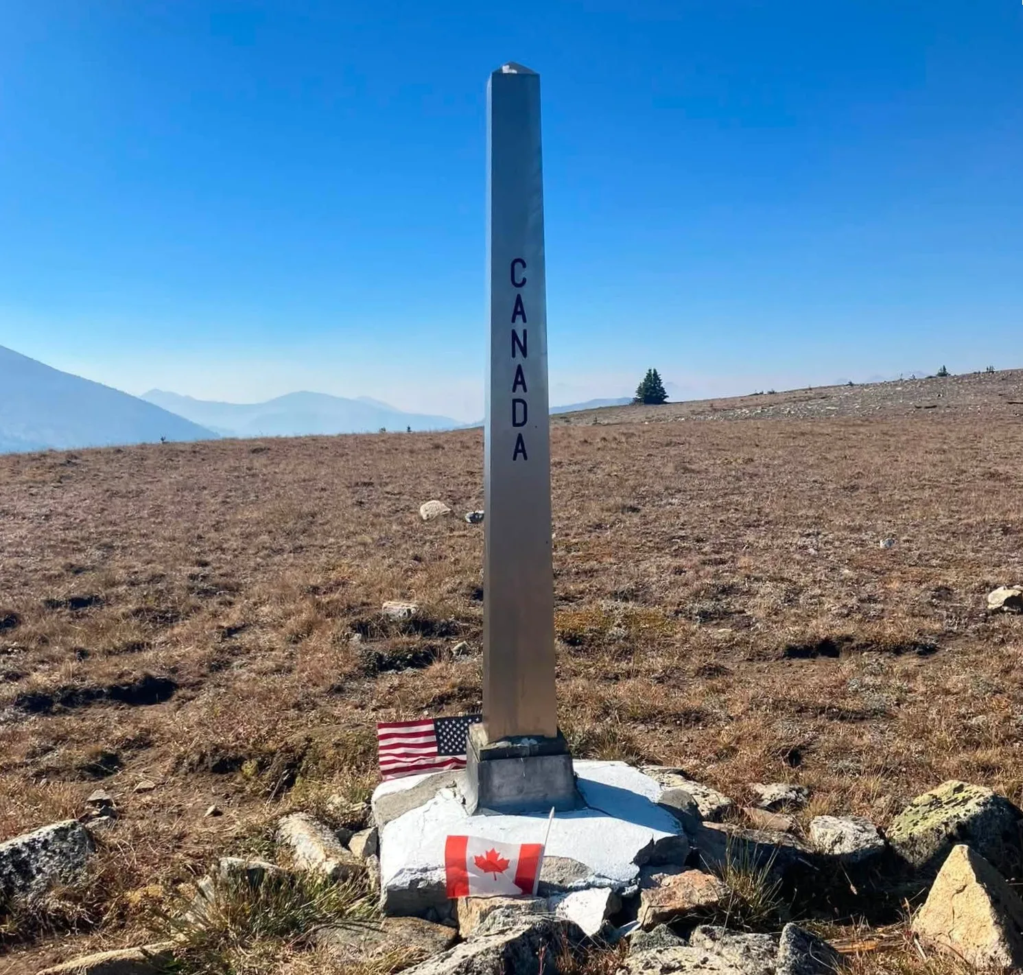
If Monument 78 is unreachable due to trail closure, then Monument 90 is a popular alternate for touching Canada. Below is the most direct route there. Because the trail to M90 intersects the PNT three miles south of Canada, you can get there by traversing on the PNT from many locations.
Monument 90 from Billy Goat Trailhead
Billy Goat Trailhead is reachable via Forest Road-5130 out of Winthrop, WA.
It's 21.8 hiking miles from the trailhead to Monument 90 with 5,803 ft. total elevation gain.
If you exited the PCT at Harts Pass, that was 30.3 miles short of the northern terminus with 6,738 ft of gain avoided.
There are numerous intersections with other trails so a GPS map is highly encouraged to help avoid a wrong turn. I'll spare you coordinates and KML/GPX files and will just assume you know how read your map app.
Starting from the Billy Goat Trailhead you will take Trail #502 all the way to the PNT, then you will take Trail #506 to Park Pass.
- (0.0) Note; this route crosses multiple burn zones from 2017 and 2018. The trailhead is in a burn zone.
- (2.4) From Billy Goat Trailhead it's a non-stop shade-less climb to Billy Goat Pass.
- (4.3) Then you get to lose half of that gain by dropping into the Drake Creek valley. The good campsites are south of the Drake Creek crossing.
- (4.78) Cross Two Bit Creek and begin the short climb to Three Fools Pass
- (5.72) Enter a burn zone as you drop again to Diamond Creek which you cross. You will leave that burn zone as you enter the mouth of the Larch Creek valley.
- (8.0) Enter Larch Creek valley as the trail curves to the right. The trail follows Larch Creek all the way to Larch Pass, crossing it more than once.
- Water - To this point you've had frequent creek crossings. Upper Larch Creek is your last good water source until the spring at Sand Ridge. The trail crosses Larch Creek at just over 6,000 ft. I suggest you water-up there. Larch Creek may be flowing higher up, but may not. If you get yourself into a desperate water situation there are out-of-the-way side trail to lakes you can see on your map.
- (9.5) You will enter a burn zone and will stay in it, or next to it, until McCall Gulch.
- (12.8 ) Larch Pass seems to have avoided the fire but the east slope is burned.
- (13.5) After larch Pass you will traverse a slope over McCall Gulch to the west.
- (14.3) Unnamed Pass
- (14.5) Look down on Crow Lake to the east.
- (16.5) The green cirque just north of Sand Ridge is a lovely spot to camp. After you drop into the cirque from the south, at about 7,100 ft the trail turns 90d to the right. At that turn you should find a spring.
- (17) Before Pevee Pass you will enter a burn zone and you will be in it until you reach the SW side of Sheep Mountain.
- (17.5) Pevee Pass - Join the PNT by going left.
- (18) Only 1/2 mile after joining it, you will leave the PNT by going right onto Sheep Mountain Trail #506
- (20.5) Just bellow Park Pass leave Sheep Mountain Trail by going straight up hill to Park Pass just 80 feet above you.
- (21) From Park Pass its 1/3 mile to the border. You will not know when you reach it. There are no trees so there is no clearcut slash.
- (21.3) The one switchback will take you into Canada and back again after giving you a view north, down into the oasis where Border Lake waits.
While the location of the monument was surveyed in 1860, the original stone Monument 90 was placed there in 1906. It was later replaced with the stainless steel one you see now.