2026
There are at least 11 landslides on Railroad Creek Road. The road is closed and will likely stay that way for at least the 2026 season. It's not a good year to make Cloudy Pass part of an alternate route. But I still think Cloudy Pass and Lyman Lakes are a worthy side trip from the PCT. It's only 5.12 miles and 1,386 one-way to the upper lake. And there are three camps on the east side.
I do not think a side trip beyond Lyman Lake is worth it now, with the road closed, Holden Village closed, and possibly the ferry not running.
If you would like to do a side trip to Cloudy Pass and/or Lyman Lakes, just use the top half of these instructions to plan your trip. These instructions are written for readers hiking east starting from the PCT.
Cloudy Pass
(Depart PCT at mm 2555.85) This gorgeous 11 mile trail is used in many ways: It can be a 30 mile loop through Stehekin, or an alternate route bypassing the 18.6 miles of PCT between High Bridge and Suiattle Pass, or an entry/exit rout to the PCT via Chelan. All three purposes require using the ferry and busses.
Some hikers might choose to make this a side trip from the PCT, going the 5.2 miles, and 984 ft (one way) to Upper Lyman Lake, then back to the PCT. Or, to shorten the trip, go only to Lower Lyman or only to Cloudy Pass. All are well worth it in my opinion.
At 6,434 ft, Cloudy Pass is an almost treeless meadow offering stunning views of Plummer and Sitting Bull Mountains to the west, then to the east, a long ridgeline of glacier covered peaks over 8,000 ft high overlooking the milky blue Lyman lakes.
Departing the PCT
The trail forks and connects to the PCT in two spots.
One connection is 0.2 miles south of Suiattle Pass at 5,920 ft. This route is a nearly level traverse of 0.5 miles, but the traverse is on a very steep rocky slope that some people do not enjoy.
The other connection to the PCT is 0.7 miles north of Suiattle Pass at 5,685 ft. This route has some tight switchbacks over 0.8 miles but is a more sure-footed route. The two connections merge into one trail at 5,920 ft. Then 16 more switchbacks take you 514 feet directly uphill to Cloudy Pass.
Over the 1.6 miles from the PCT to Cloudy Pass the trees thin out to the tree line, offering 360 bucket-list views of the 8,000 ft high peaks surrounding you: Cloudy Peak to the north, Plummer Mtn to the west, Fortress Mtn and Chiwawa Mtn to the south, Greenwood Mn to the east. And below you to the SE you will Lyman Chain lakes.
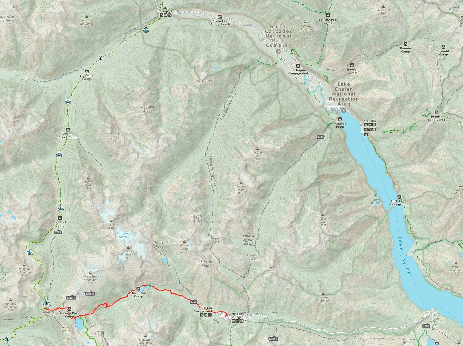
Photo: Lyman Lakes from Cloudy Pass
As you descend toward Lyman Lake, you will not see this through the trees, but 2.3 miles in, at 6,000 ft, you will pass by a very important weather station 70 yards to the west.
Lyman Chain Lakes
Taking extra time to explore Lyman Lakes is well worth it. It's an extra 2.8 miles and 506 ft one way to Upper Lyman Lake. The route there is not intuitive and I recommend using GPS guidance. The trail around the west side of the lake turns into rock climbing Lyman Falls, so that is not the best route to the upper lakes.
The real route to the upper Lyman lakes begins about 3 miles in, by crossing the outlet of the main lake and traversing upward along the steep east side of the lake. At 6,000 ft be careful not to accidentally get on Spider Gap Trail. At that intersection the lake and the trail down to it are easily visible.
You won't see them, but there are numerous old mines and claims around you based on discoveries of lead, silver, gold, copper, beryllium, and molybdenum.
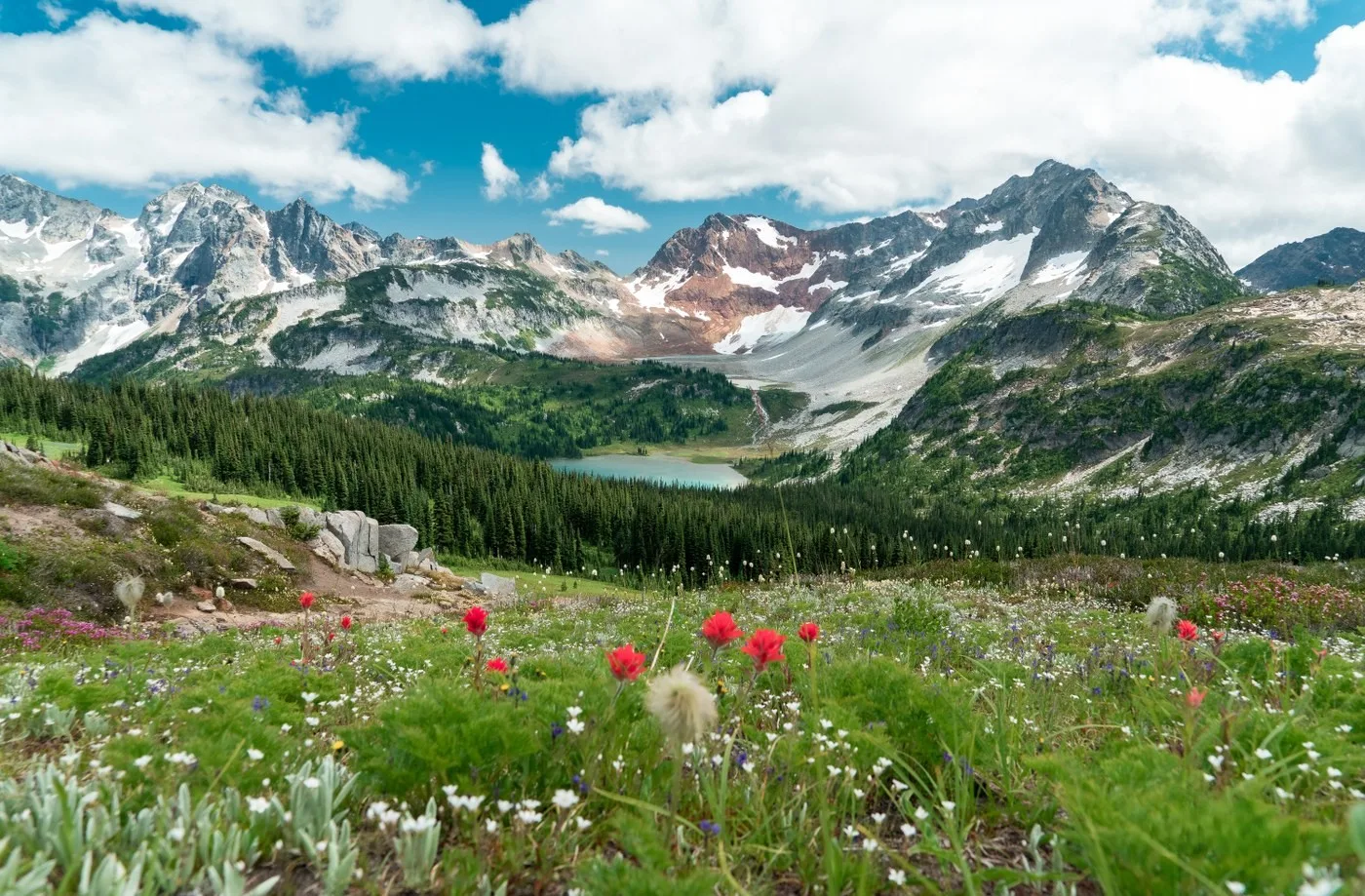
Photo: Lower Lyman Lake looking north
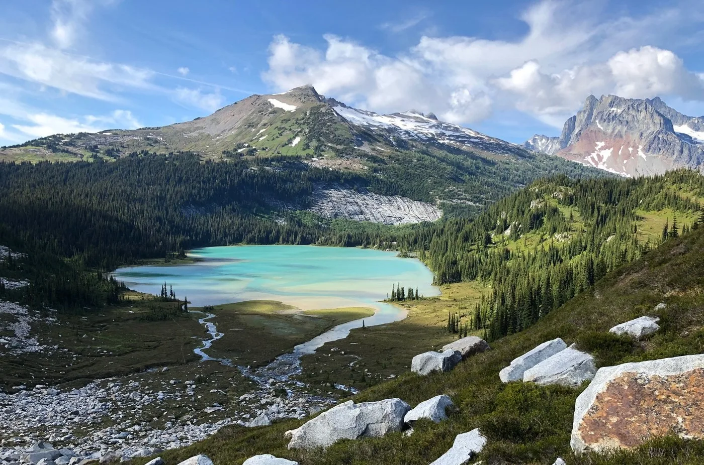
Photo below: Upper Lyman Lakes looking north
Greenwood Falls
At 3.33 miles there is an intersection with Crown Mine Trail which leads south, then east, past a 1897 molybdenum mine that had a mill on the south side of the creek at Crown Point falls. At this trail intersection you are next to Greenwood Falls. As you hike down-valley from Greenwood Falls you may get views of it by looking back to the SW. 3.65 miles in there is side trail that goes south for 0.2 miles, down 50 ft, to an incredible camp site on the north side of the river bend with a view upstream of Greenwood falls. Please leave no trace and poop near the main trail, not the creek.
Hart lake
6.8 miles in you will reach Hart Lake. There is a pit toilet above at Hart Lake at Hart Lake Camp, please use it when in this area. The inlet delta at Hart Lake is a great unofficial place to camp (LNT!)
Note that this trail it typically a bit overgrown below Hart Lake and that will only get worse in 2026 with the closure. Bugs in early summer are also typical.
8.65 miles in you will cross Holden Creek.
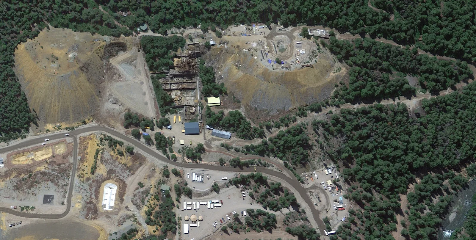
Holden Copper Mine
As you approach Holden you may see the gravel fields on the south side of the river. This is a large EPA superfund clean-up site. It was built to remove arsenic, lead, molybdenum, sulfur-pyrite, and uranium from the runoff from huge tailings piles left when the mine was closed in 1957.
The mine produced mostly copper but also gold and zinc and employed about 600 people. The site was claimed the summer of 1896 by James Henry Holden who found a copper outcropping there. But mining operations did not begin until 1938, 20 years after his death.
The clean-up project started in 2012 and was completed in 2016. An underground barrier wall was built, and the creek rerouted, to prevent runoff from entering the creek. This site includes a large water treatment plant.
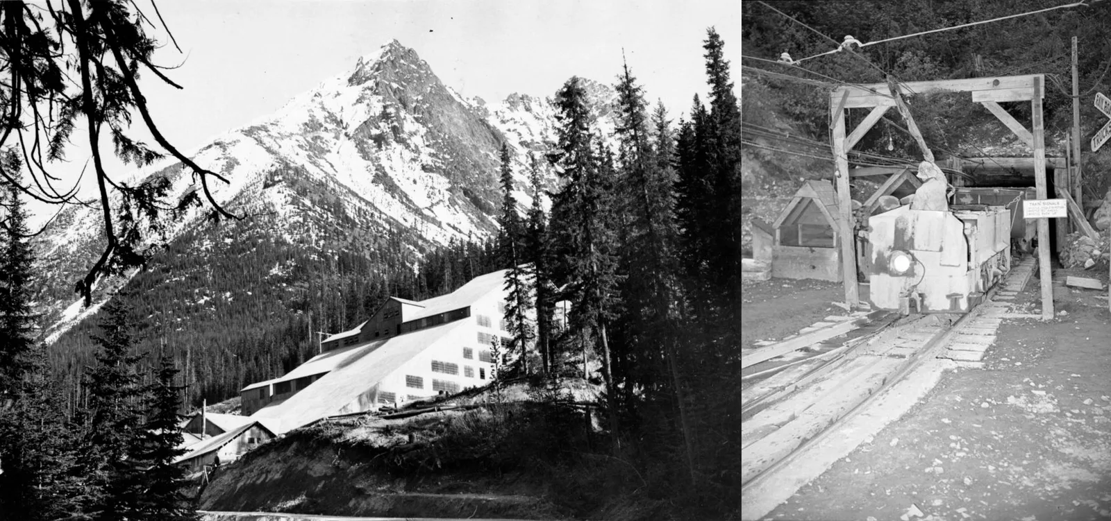
Photos from before the clean up:
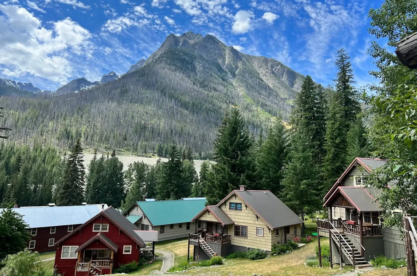
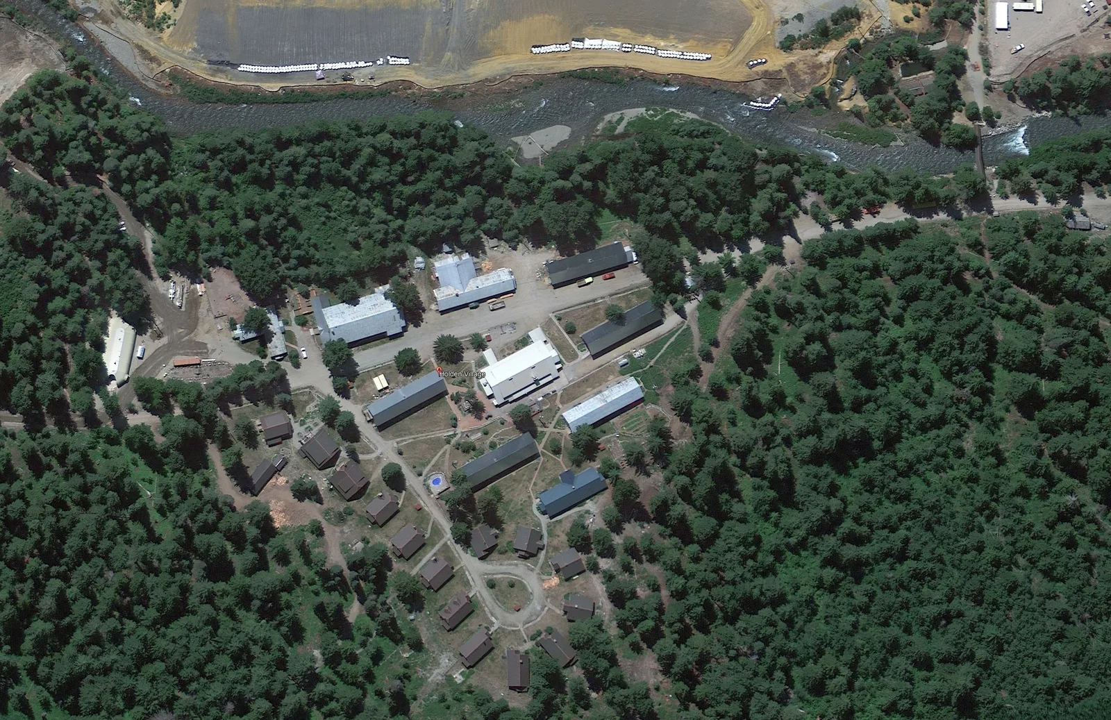
Holden Village
You arrive at Holden when the trail turns south to cross a gravel road then a bridge. You should see some yellow school busses ahead parked near the bus stop. To go to Holden Village, do not cross the bridge, instead follow the gravel road east.
Holden Village was deeded to Seattle Lutheran Bible Institute in 1960 by the Howe Sound Mining Company for $100K. They hold a special use permit from the US Forest Service, who owns and maintains the road. The village was closed in 2012 when the mine clean-up began and repurposed to house and feed the construction workers. During that time the village infrastructure was improved by the church. The village reopened to guests in 2021.
The forest on both sides of Holden and all the way down to Lake Chelan may appear to be young. A wildfire burned the area in 2015 but thankfully went no further up the scenic valley.
Transportation via lake Chelan
The bus is operated by Holden Village. It operates by reservation only, and only to meet a scheduled ferry. Priority is given to Holden Village guests who ride for free. I suggest calling ahead.
For the current ferry schedule see the public transit page.
Hiking to Lucerne
In 2026 there won't be a bus running. No bus might also mean no ferry running. But there is a hiking trail from Holden to the ferry dock that runs along the south side of the valley. It's 1.3 miles long. If you hike it uphill, its 2,856 ft of elevation gain. You can even stop at Domke Lake and camp there.