All of these streams are easily crossed in September, but some can be dangerous in the spring or after a heavy rain.
If there is snow in the watershed then the stream level should be lower in the morning when the temperature is lower. Rain will cause water levels to rise, sometimes rapidly.
Tips on crossing
If you are alone and encounter a stream crossing that gives you pause, I recommend waiting until another hiker comes so you can cross together.
Before crossing, look downstream for obstacles and opportunities in case you are swept down-stream. Trekking poles add stability (keep the straps on your wrists). When crossing a stream, unbuckle the waist strap and use only one shoulder strap (the down-stream side). In strong current face up-stream and walk sideways, leaning hard upstream. If you fall, try to fall upstream onto your hands, not your back. If you are crossing on a log, falling off the upstream side of that log could pin you under that log or against it. Better to fall on the downstream side of the log.
Kennedy Creek
Section K West of Glacier Peak
PCTA mile marker 140.25 / 2515.5, Lat long: 48.12471, -121.17078
A sturdy bridge over Kennedy Creek was destroyed in the 2003 floods. A replacement was built, one log with two handrails. That bridge cracked in half, the center touching the riverbed, but was still usable for many years. In the spring of 2021 hikers discovered the bridge had been completely washed away. Kennedy Creek is a high flow creek because it is fed year-round by a glacier and large watershed.
There is no viable alternate route. The old alternate route along White Chuck River Trail and Kennedy Ridge Trail was destroyed by flooding and mudslides in 2003.
Adams Creek
Section H West side of Mt Adams
PCTA mile marker 410.5 / 2245.4, Lat long: 46.24298, -121.54331
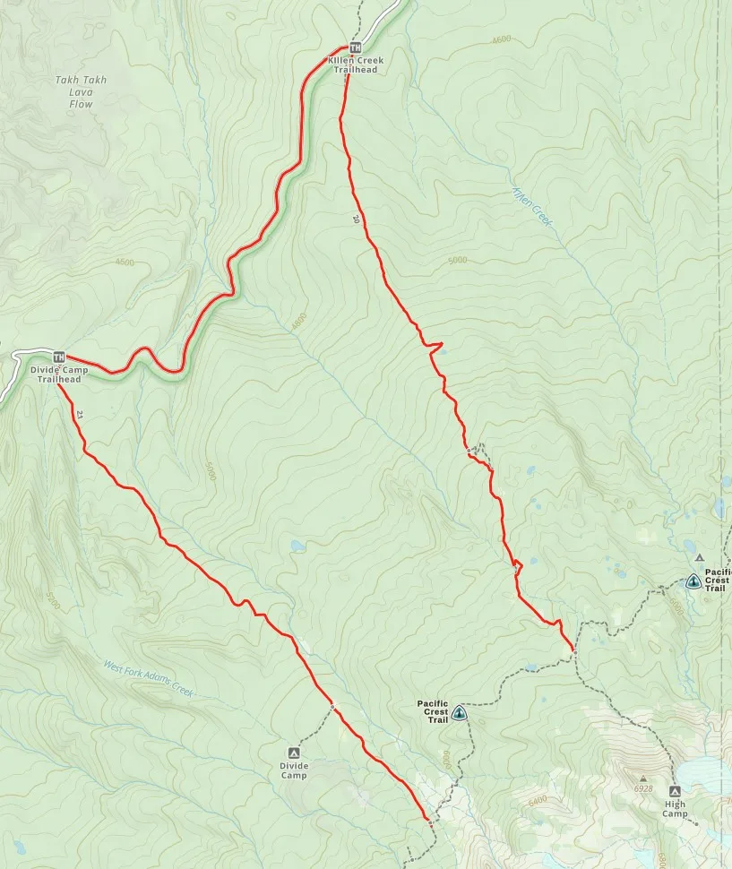
Adams Creek is a high flow creek because it is fed year-round by the Adams Glacier and large watershed. It is a braided creek with two or more paths to cross.
No-Name Creek
Section J Above upper Hyas Lake, midway between Snoqualmie Pass and Stevens Pass
PCTA mile marker 211.5 / 2444.35, Lat long: 47.57720, -121.14405
While No-Name's source is not Pea Soup Lake, it is a potentially dangerous stream because it has a large watershed above it with deep snow deposits, and because the north side of the stream is constrained by a sheer rock wall. The trail crosses the creek right where that north rock wall ends. If crossing looks difficult, try moving a bit downstream and you may find a better spot.
Lemah Creek
Section J West of Pete Lake
PCTA mile marker 239 / 2417, Lat long: 47.47686, -121.26166
Lemah Creek once had a sturdy 50' bridge. It was washed completely away in 2009. You will still see the large footings on either side of the creek.
In the spring when the water is high and fast, I prefer the lower Lemah Creek alternate route over the regular route. The alternate route is only 0.07 miles longer than the regular route and it actually saves you a small amount of elevation gain in either direction. The creek is much wider at the alternate crossing point, thus is less deep. Each year logs assist crossing in different locations chosen by nature.
NEW in 2026: Waptus River
Section J West end of Waptus Lake
PCTA mile marker 224.5 / 2431
This sturdy bridge was washed away in the winter floods sometime before the spring of 2026. This bridge was constructed much like the Lemah Creek bridge. While deep, it's smooth water over a smooth river bed so is a rather easy ford.
There is no real alternate route to avoid this ford. If you don't ford at the west end you still need to ford at the east end, though the east end is usually wider and more shallow.
South Fork Agnes Creek - easy cross
Section K Between Stehekin and Suiattle Pass at Hemlock Camp
PCTA mile marker 93.25 / 2562.6
This bridge washed out a couple years ago. as of July 2026 there is still a log jam there that makes for an easy dry crossing. There is no real alternate route to avoid this ford.
Bumping River - easy cross
Section I north of White Pass
PCTA mile marker 344 / 2312
I don't know that there has ever been a bridge here but its the largest stream to cross in this section. It's a dry cross in the later summer, but in the spring it can be a flowing river. Typically there are logs to cross.
Alternate Routes
Lemah Creek
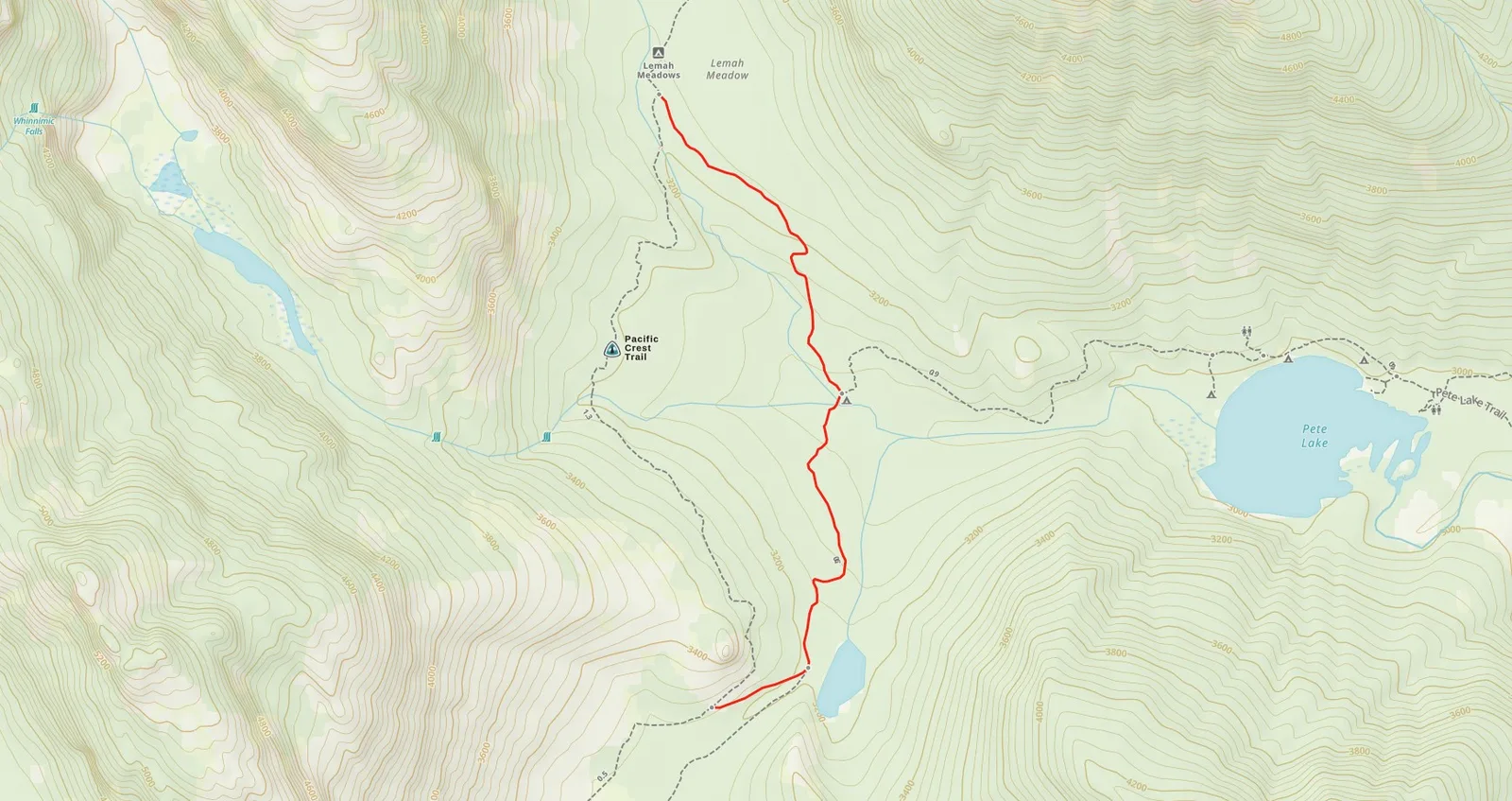
Lemah Creek is a potentially dangerous creek because it has a large watershed above it with deep snow deposits on Lemah Mountain. Heavy rains can cause this creek to rise rapidly.
No-Name Creek
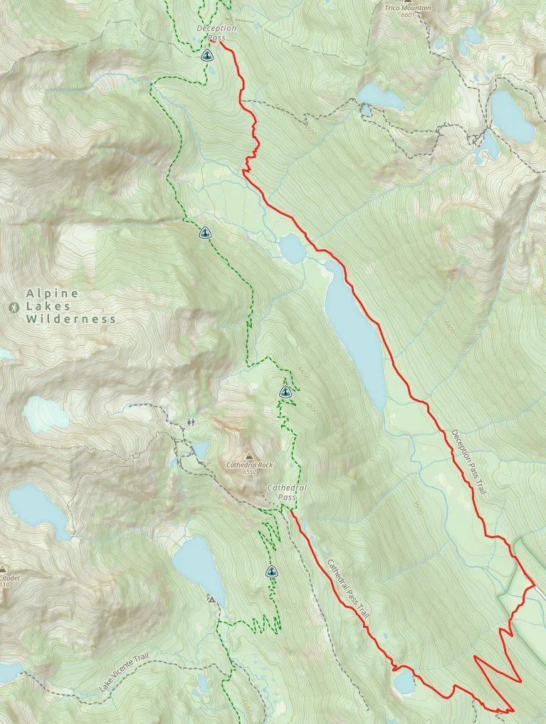
If you believe No-Name creek to be impassible you can avoid it by taking the Cathedral Pass Trail and Deception Pass Trail around the opposite side of Hyas Lake. This is a 8.67 mile detour which is 3.79 miles further than the normal route. It adds 374 ft more elevation gain going northbound and 369 feet more going southbound
Adams Creek
If you believe Adams Creek to be impassible you can avoid it by taking the Divide Camp Trail and Killen Creek Trail. This 8.4 mile route is 7.08 miles longer than the PCT route. It adds 1,506 ft of elevation gain going northbound, and 1,539 ft of elevation going southbound