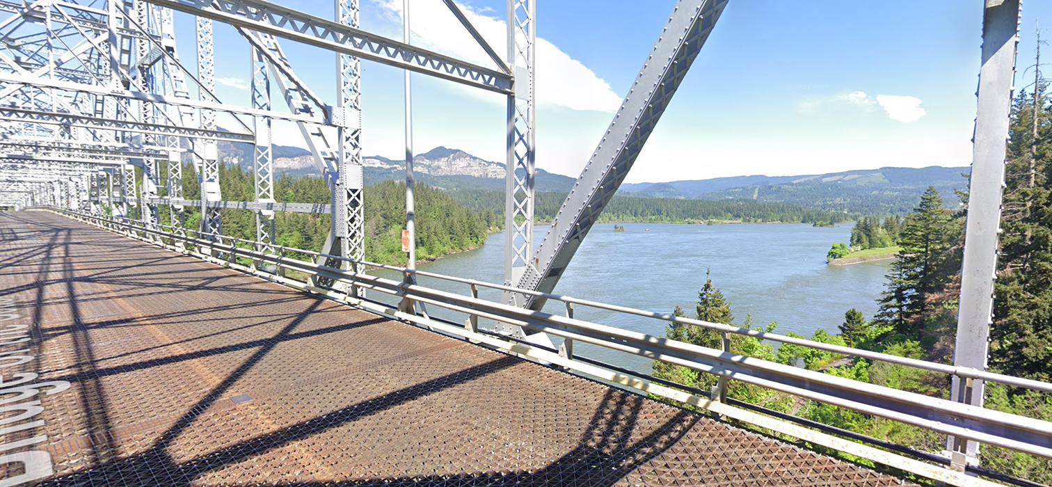
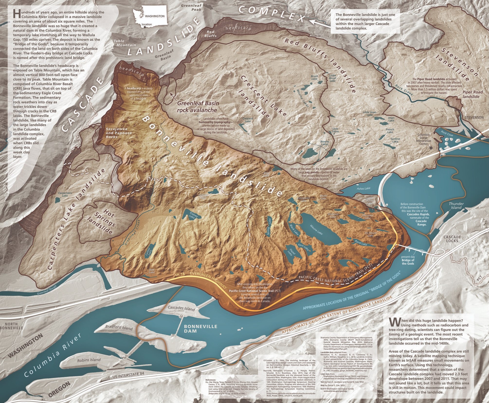
(mm 2150.1) PCT hikers heading into Washington State from Oregon might want to stop just on the north side of the toll station, and observe the bare face of Table Mountain, just to the right of the bridge structure. Also, more in line with the bridge you might see the rocks named Sacagawea and Papoose. As you first step onto the metal bridge grates, you might also look up river to the east and notice how the river narrows as it approaches the bridge, reducing the distance across by about 3/4.
That is because the north shore is one mile closer to you than it was about 600 years ago. You are walking towards a massive landslide that started at the peak of Table mountain cleaving it in half and exposing the bare cliffs you see to the east of Table Mountain. In fact, that landslide once touched the south bank, completely blocking the river and creating the original land Bridge Of The Gods.
That land bridge lasted only a few years until the river rose up and cut through the natural dam right below where you stand now. Then the river rushed though these narrows scouring silt down to bedrock and creating the Cascade Rapids. The rapids blocked ships coming from the Pacific (west) and canoes coming downstream including those of Lewis and Clark in 1805.
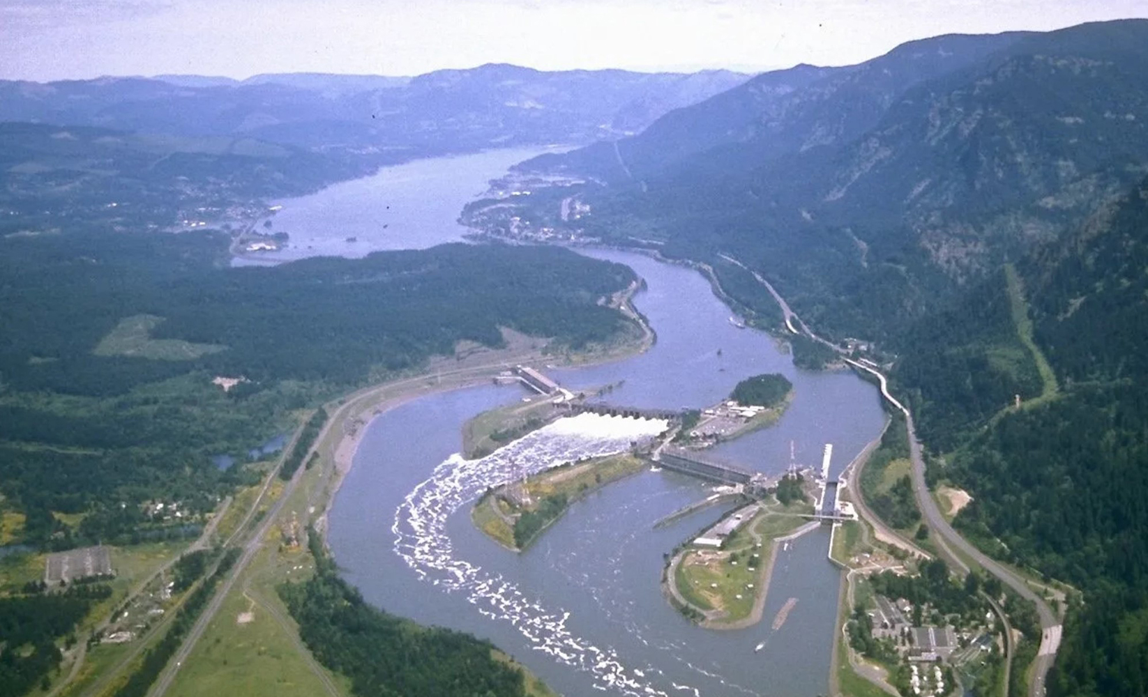
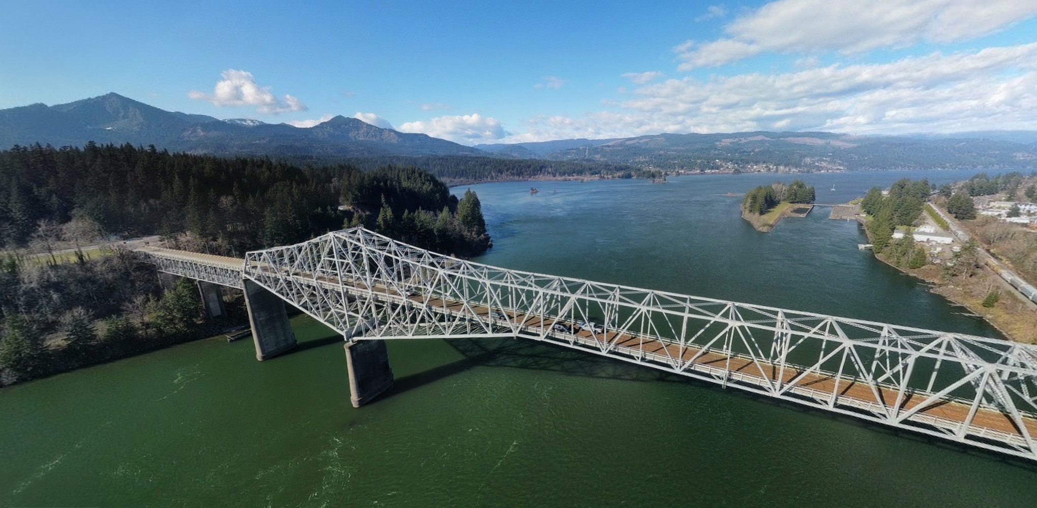
What you cannot see from the bridge is the dam around the bend to the west. In 1938 the dam submerged the rapids to create the navigable waterway you are now crossing over on the new (1926) man-made, Bridge Of The Gods.
Photo: Table Mountain in the distance.
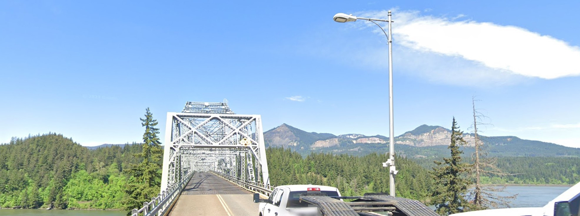 Photo: The river narrows dramatically as it nears the bridge.
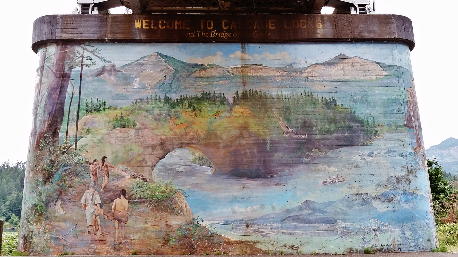
You may have already learned some of this if you saw the mural and plaque underneath the bridge on the south end.
Humans and the river
It's quite fitting that northbound PCT hikers enter Washington by crossing one of its most defining features. The Columbia River is one of the major geographic features that guided human history here by enabling or blocking movement. Other such features include the Pacific Coast, Puget Sound, the Rocky Mountains, and the Cascade Mountains dividing east from west. Non-native people slowly learned by exploration what the natives already knew; the Columbia River was a natural highway connecting the Pacific Ocean with Walla Walla to the east, with Lake Chelan to the north, with Canada at the NE corner of the state, and with Idaho in the SE corner of the state via the Snake River.
Humans have lived around the river for at least 15,000 years, with salmon-based villages at least 3,500 years ago. The tribes along the river had different names for the river, all translating to "big river". Reliance on the river for transportation reduced somewhat in the early 1700's as the Shoshone, Nez Perce, Cayuse, and Flathead tribes aquired horses, desendants of those brough by the Spanish.
Early non-native river exploration
The name Columbia stuck with non-natives after Robert Gray, a Boston trader sailed up the river in 1792 and named it for his ship. Later that same year, the British Navy HMS Chatham explored the lower river with Capt. Gorge Vancouver and Lt. William Broughton on board. 17 years prior, Spanish explorer Bruno de Heceta was the first to accurately describe the location of the mouth of the river.
Lewis and Clark observe the result of the landslide
Lewis and Clark came down this river in 1805 on an exploration mission ordered by President Thomas Jefferson two years after the Louisiana Purchase. With them was interpreter Sacagawea and her 8 month old baby son who had been with them since he was born in North Dakota.
Using Broughton's notes from 13 years earlier, they knew the sighting of Mt Hood meant they were close to the Pacific Ocean, which they reached in mid November.
On October 30th the expedition camped on a now-submerged island just upriver from today's Cascade Locks, OR. The following day they began portaging their canoes and equpment about a mile down stream past the rapids which were where the bridge is today.
From their 30 October 1805 journal entires: "passed Several places where the rocks projected into the river & have the appearance of haveing Seperated from the mountains and fallen promiscuisly into the river."
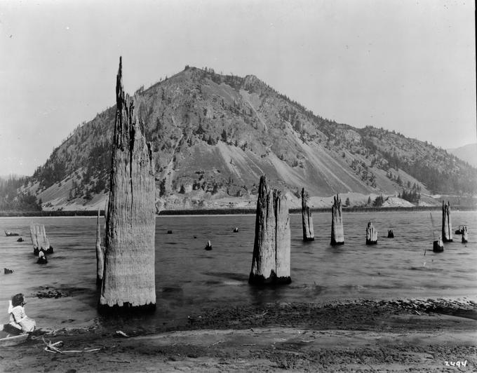
Clark documented the presence of a submerged forest "a remarkable circumstance in this part of the river is, the stumps of pine trees are in maney places some distance in the river, and gives every appearance of the rivers being damed up below from Some cause which I am not at this time acquainted with. This part of the river resembles a pond partly drained leaving many stumps bare in & out of the water."
Late that same day the expedition encountered the head of the Cascade Rapid complex, which they portaged around for the next three days passing the current location of the Bonneville Dam on Novebmer 1st.
Lewis repeated the observations of the submerged forest again on his way back, on 14 April 1806.
In his 1844 book 'Ten Years in Oregon' Daniel Lee, related: “The Indians assert that the river was dammed up at this place, which caused the waters to rise to a great height far above, and that after cutting a passage through the impeding mass down to its present bed, these rapids [the Cascades] first made their appearance.”
Photo: In 1900 one could still see the stumps of trees that had slid into the river and whose bases were buried under many feet of silt.
Dating the Bonneville Landslide
Radiocarbon dating of a few submerged stumps yielded dates sometime between 1425 and 1450, roughly 350 years prior to the arrival of Lewis and Clark.
How long it took the Columbia River to fully breach the landslide and for the impoundment to completely drain is unknown.
Salmon runs, rapids, and dams
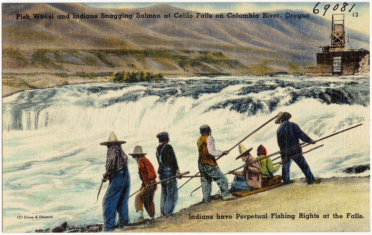
It's estimated that 10 to 16 million salmon migrated up the Columbia each year around 1800. Since 1938 when records began, the biggest salmon run was 3.2 million in 1986. The best fishing sites were the rapids, but the rapids blocked shipping up-river, so one by one all the rapids were damed and flooded.
The completion of the Bonneville Dam in 1938 allowed stern wheeled steam ships to take passengers further up the river, as did every subsequent dam built upstream just below the next rapids. The impact of the dams on salmon runs is still a topic of debate. The river provided such an easy way to access the interior of the state, that it delayed need to build roads accross the Cascades.
The Bridge
1928 video Building the BOG