Establishing the border
The Treaty of 1818 established the border at the 49th parallel but only so far west as the Rocky Mountain crest.
In 1846 Great Britain and the United States ended a dispute over what is now the western 2/3rds of Washington, and agreed the boundary at the 49th parallel would continue west all the way to salt water. Canada was pushing for the border to be defined by the Columbia River.
The US/Canada border is defined by straight lines unlike the US/Mexico border which is primarily defined by geographic features like rivers.
Marking the border
In 1856 the U.S. Congress authorized a North West Boundary Commission to survey the 49th parallel. Between 1858-60 this rugged terrain was surveyed and marked using celestial navigation with remarkable accuracy.
The first monuments consisted of loose rock cairns, 6-8' in height. None of these remain today. Monument #1 is quite large and was placed in 1865 in Monument Park, Point Roberts. Monuments 0-4 are all in Point Roberts. The first monument on the mainland is monument #5 on the beach in Blane, WA.
In 1906 & 1907 the present obelisk monuments were erected as an on-going boundary verification effort. These monuments span not only the Canadian border with the continental US but also with Alaska. In mountainous areas, these monuments are generally placed at high points, and on either side of rivers. Their numbering has nothing to do with distance, but more with topography. The border is marked by more than 8,000 monuments and buoys. The boundary between Washington State and British Columbia is 427 miles long (687 km) and has 195 border monuments. The newest generation of monuments are made of stainless steel.

The Slash
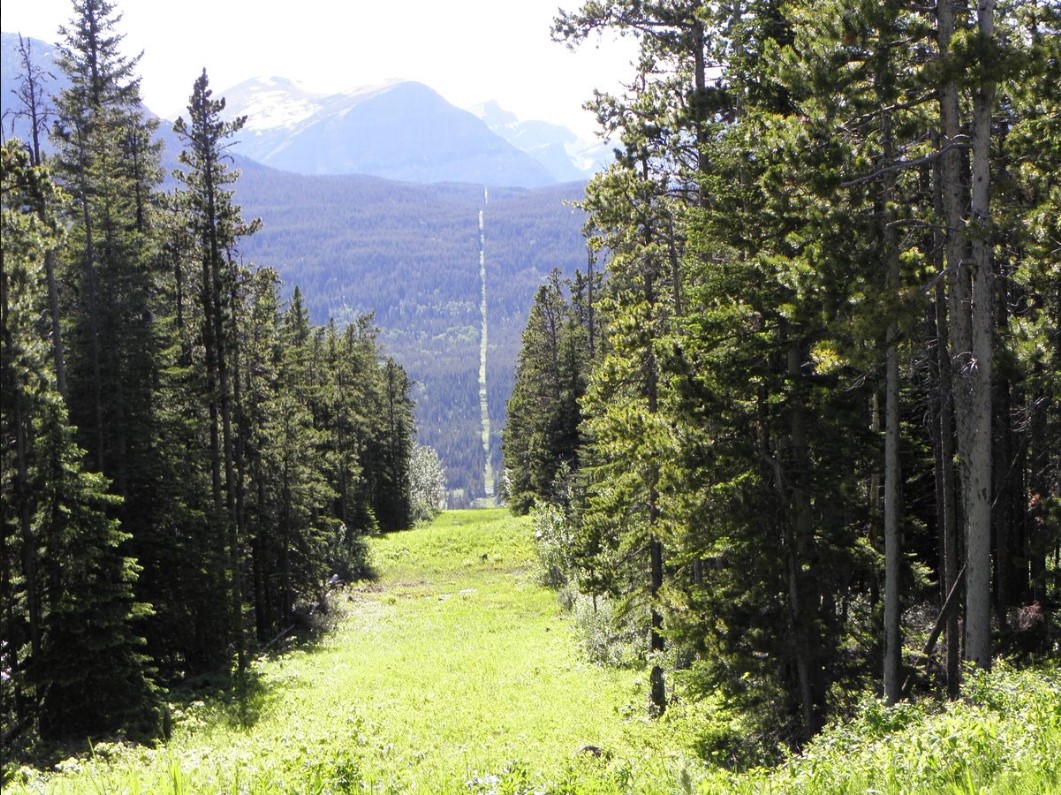
1925 made permanent the International Boundary Commission (IBC) responsible for maintaining the monuments and clearing trees from a 20-foot vista (10 feet on either side of the border) called "the slash".
The US and Canada split the cost 50/50.

Surveillance
The slash was originally cut simply as a way to designate the border so that no crossers could claim ignorance. But the slash turned out to be a needed prerequisite for modern surveillance technology. The Customs and Border Protection agency is in the process of installing solar powered slash camera poles which use thermal imaging and optical cameras. Areas still lacking these poles can be surveilled from satellites.
Monument 78
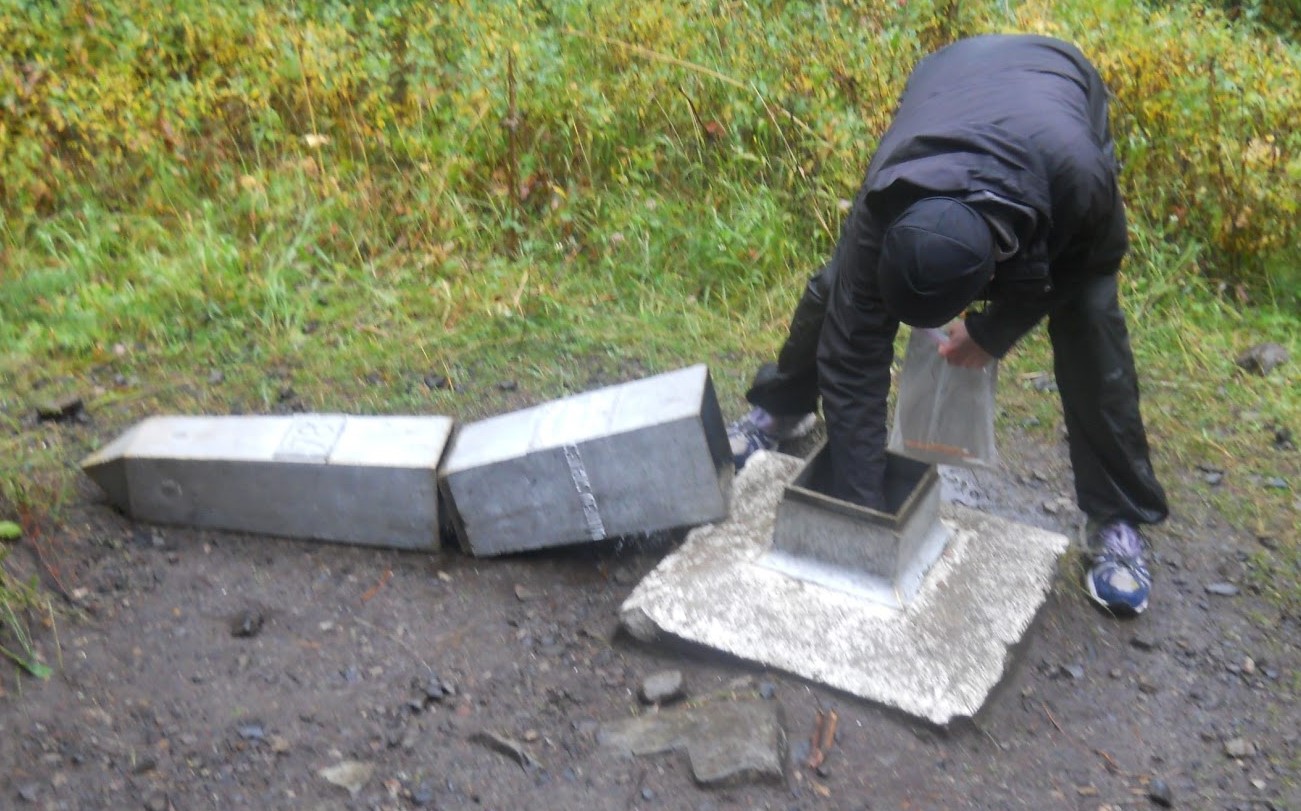
Monument 78 is the border Monument at the PCT northern terminus, on the east bank of Castle Creek. It is a metal obelisk approximately 5' tall mounted on a concrete pad.
Prior to 2018, the top two sections of monument 78 could be lifted off to access the logbook in its base. Then the obelisk was filled with concrete and the pieces were welded together.

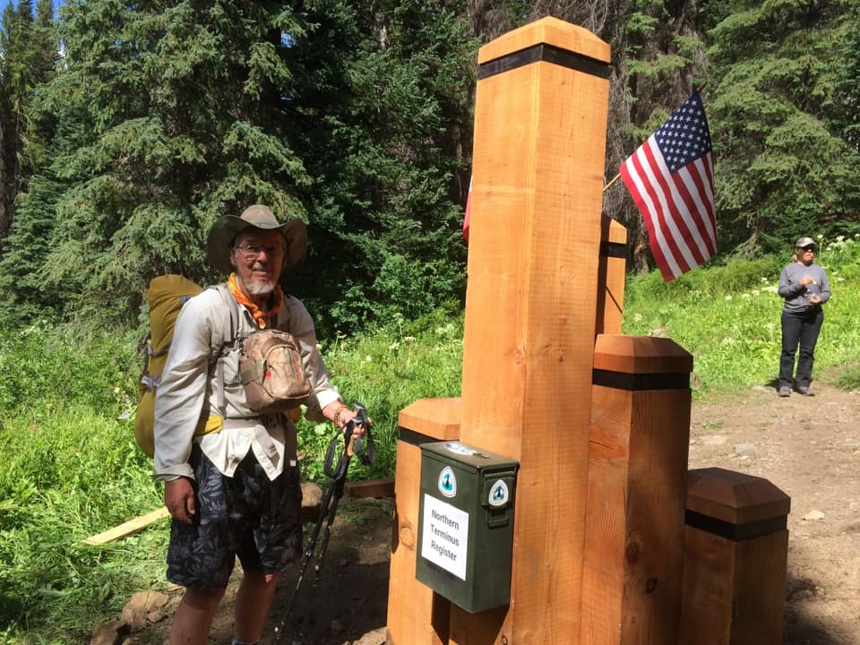
The logbook is now in a metal ammunition box attached to the back of the wooden monument. The logbook is collected and replaced by a PCTA volunteer in early June each year.

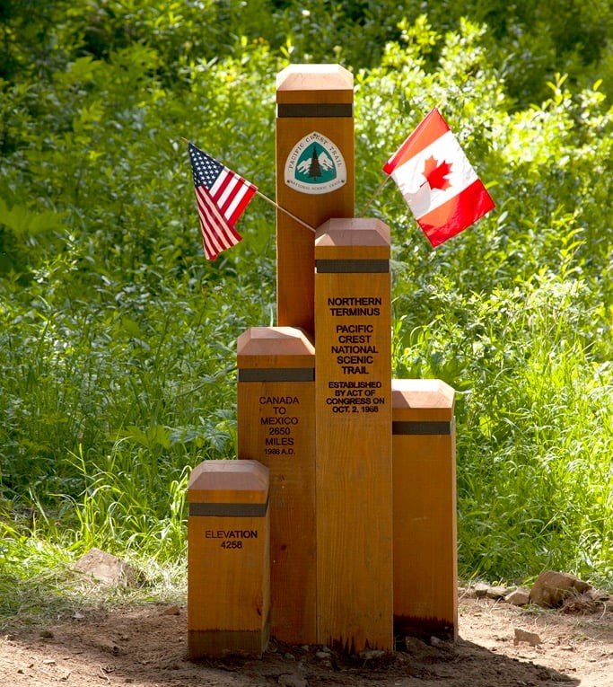
The PCTA Northern Terminus Monument
The wooden five-pillared Northern Terminus Monument was first installed in 1988 to celebrate the PCT's 20th anniversary, and was replaced
in the fall of 2018. It stands right next to monument 78, on the US side.

Border crossing policy changes
Southbound crossing prohibited 2010
In June 2010 John Modlin, head of the US Customs and Border Protection (CBP) determined that there is no legal southbound entry into the United States at the northern terminus of the PCT, ending more than 70 years of hikers hiking sount from Manning Park British Columbia. The CBP issued a press release on July 1st, 2010 reminding hikers of the law and explaining that penalties could include a year in jail and $5,000 fine. The letter was repeated in numerous newspapers and on the PCTA web site. The CBP is a sub department of the Department of Homeland Security, then lead by Janet Napolitano. https://dev.pctwashington.com/canada
Permit System 2020-2025
Prior to the 2020 Covid-19 lockdown hikers could enter Canada via the PCT and then present their long-distance permits to border guards when they returned to the US at a highway border station. Now any trail crossing at the border is prohibited.
The US/Canada border has been completely closed twice, September 11th 2001, and again March 21st 2020. Prior to March 2020, hikers were allowed to cross the border in either direction without any special permits. Prior to January 2007 only a drivers license or birth certificate was needed to cross the border. After that new US DHS rules were put in place.
Today a permit from the Canada Border Services Agency is required to hike north accross the US/Canada border. Hiking south into the US is not allowed.
Northbound crossing prohibited January 2025.
On January 25th 2025 the Canada Border Services Agency posted this page announcing the end of all entry to Canada from the US via the PCT. and on January 27th they posted this news release PCT hikers wishing to reach the border and northern terminus monument will need to then hike back to a trail exit point in the US such as Harts Pass.