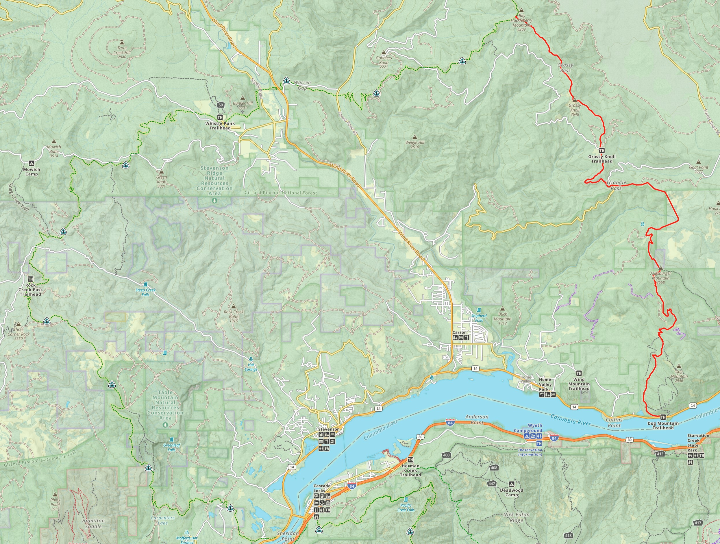
The Pacific Crest Trail from Mexico to Canada was created by connecting established trails. In Washington that trail was the Cascade Crest Trail which ran the length of the state. The CCT was officially established in 1938 by the Forest Service and the YMCA. The earliest route map I have seen is from 1937. Much of today's PCT route is the same as it was in 1937, but in a few sections the route has changed. One of those sections is the first 42 miles of the trail north from the Columbia River.
Based on a 1962 map, the CCT started at the Dog Mountain Trailhead which is on Highway 14 twelve miles east of the Bridge of the Gods. The CCT followed today's Augsburger Trail around Dog Mountain to the peak of Augspurger Mountain, a 4,263 ft climb over 6 miles. Today that trail ends on the north side of Augsburger Mountain. Anyone wishing to follow this old route today will have to wayfind around the headwaters of the Little Wind River between Augspurger Mountain and Triangle Pass. At Triangle Pass Forest Road 68 will take you to the Grassy Knoll Trailhead. The Grassy Knoll Trail folllows the ridgeline N/NW to Big Huckleberry Mountain where it connects with todays PCT route.
Go to Snoqualmie Pass to Deception Pass
