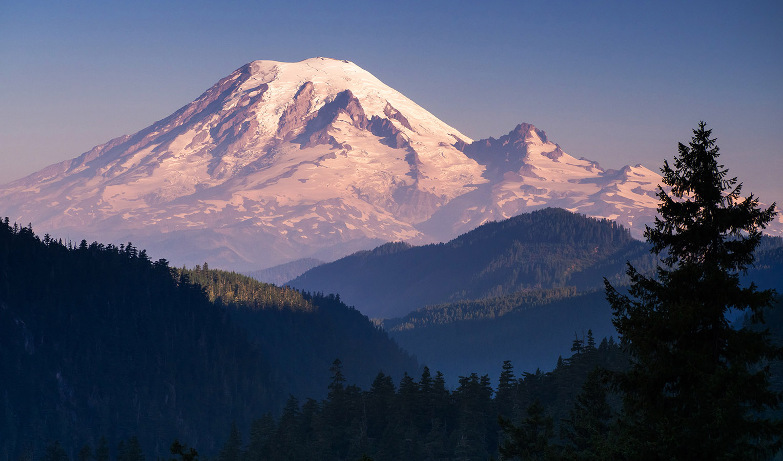
(mm 2316.2) If you look W/NW you will see Mt. Rainier (Mount Tahoma). It's summit is 15.7 miles from you. For the next 10.5 miles, going northbound, you will be getting closer to the mountain, but as the PCT gets closer to the mountain, the more your view of it will be blocked by obstacles between you. One of the best views from the PCT will be at mm 2321.2 just south of Anderson Lake. (Also see the Naches Peak alternate route at 2325 which offers the closest view.) Your last chance for a direct view of Mt. Rainier will be at Hayden Pass (mm 2338.4). North of there Rainier will only play peak-a-boo with you as the PCT takes you directly away from it.
Mountain stats
At 14,409 feet above sea level Rainier is the fifth highest peak in the contiguous US (Only 96 feet lower than the highest, Mount Whitney). It is the tallest volcano in the contiguous US. Rainier set the world record for annual snowfall in 1972 with 93.5 ft. Mount Baker broke this record in 1998 when it got 1.5 feet more and has held the record since.
Mt. Rainier is about a million years old. It's last eruption producing a lava flow was 2,000 years ago. It may have been as high as 16,000 ft then. At least three major eruptions since then created incredibly destructive lahars (a pyroclastic soup mixed with flash-melted snow and ice) that scoured river valleys for many miles, sometimes all the way to Puget Sound. Between 1840 and 1890 there were reports of steam plumes coming from the mountain, but there were no eruptions that century.
Two prominent features of the mountain are both visible from the PCT on the east side of the mountain and make good points of reference; Little Tahoma is a prominent peak (11,138 ft) on the mountainside 3,300 lower than Rainier's summit. It's what remains of a large side vent where the magma never reached the surface, but solidified in the vent and was later exposed by erosion. The Cowlitz Chimneys are four rhyolite towers further to the east. They are the central vents of a long gone volcano geologists call Ohanapecosh. The tallest and southernmost tower is 7605 ft. Counting northward, each one is a bit shorter, the northernmost is 6601 ft.
Non-native discovery and exploration
1792 Captain George Vancouver
Captain George Vancouver of the British Royal Navy observed the mountain the spring of 1792 from Puget Sound and decided to name the mountain after his friend, Rear Admiral Peter Rainier. Of course the mountain already had a name. The Cowlitz tribe called it Tahoma. Admiral Rainier never saw the mountain.
1833 Dr. William Fraser Tolmie
Dr. William Fraser Tolmie, a surgeon trained in Scotland, is the first non-native believed to have explored the area of the current park. At the age of 21, he was serving as a HBC medical officer at Fort Nisqually (now Point Defiance, Tacoma). He requested leave for “a botanizing excursion to collect medicinal herbs and observe the mountain’s glaciers”. He left on August 29 with native Nisqually and Puyallup guides. They traveled approximately 55 miles up the Mowich River.
They traveled up a tributary to the peak of Hessong Rock, 1833 September 2nd, to observe the glaciers. The apex of his journey was 2.8 miles closer to Rainier and 513 ft taller than the peak named for him today (there is also a Mt. Tolmie named for him on Vancouver Island BC).
Dr. Tolmie was a strong advocate for the native people and couldn't agree with the prevailing point of view to convert the natives to Christianity. As a result of this crisis of conscience, he took a leave of absence to Europe to do postgraduate work for two years. When he returned, he was appointed superintendent of the Puget Sound Agriculture for the Hudson Bay Company. He often found himself trying to mitigate conflict between the settlers and the natives, especially in 1855-56 when tensions had turned to violence. In 1857, Dr. Tolmie attempted to prevent the wrongful execution of Chief Leschi. He was not successful, but Leshi was posthumously declared innocent.
In 1884 he published an exhaustive vocabulary of Pacific coast Indian dialects. In his 1885 book he condemned the national government for its neglect of an entire group of people. His journals were published in 1963. His final role was serving in the British Columbia legislative assembly where he was a strong proponent for Canadian confederation and advocated for the enfranchisement of women.
1870 Van Trump and Stevens
The first recorded climb of the mountain was Aug 17th, 1870, by P.B. Van Trump and General Hazard Stevens with the help of a native guide known as Sluiskin who lead them to a basecamp near Paradise.
1883 James Longmire
James Longmire summited the mountain in 1883. On his way down he found a mineral spring and opened a hotel and spa there the following year. (Iron Mike Springs is on the Trail of the Shadows in the SW corner of the park)
Exploitation
In 1854-1855 tribal treaties ceded the area around Mt. Rainier to the United States. The treaties include provisions that native people could continue to hunt and gather on the land, though interpretation of the treaties varied.
The Pacific Forest Reserve was created in 1893, a rough square, thirty-five miles on a side, with Mt. Rainier’s summit on the western edge. Then in 1897, the area was renamed the Mt. Rainier Forest Reserve and the boundaries were greatly enlarged to the west and south. Over 100 logging and mining claims were made within the reserve.
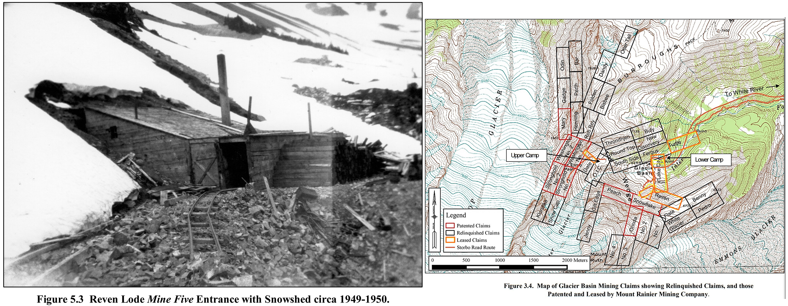
The largest of these mining operations was the Mt. Rainier Mining Company which carried out extensive mining and timber operations in Glacier Basin just below the Emmons Glacier on the NE side of the mountain. Mining in the park ended in 1908 when Congress passed legislation preventing it. The National Park Service finaly purchased all remaining claims in 1984.
Establishing a park
In 1888, one year before Washington became a state, John Muir traveled to Rainier and summited the peak. It was on this journey that he witnessed his first glacier, which spurred him to help raise awareness of the region and to eventually have it protected as a national park.
In May of 1892 Muir and Warren Olney started the Sierra Club to oppose threats to the boundaires of Yosemite National Park. In short order the club began efforts to make Mt. Rainier a national park. Muir gave numerous lectures and wrote various articles advocating for the preservation of Mount Rainier. He also made efforts to unite other organizations who were pursuing the same cause; scientists, mountaineers, conservation groups, local businesses, and railroad companies all saw possible benefit from a national park.
In an 1898 essay, he wrote of the wildflowers: "above the forests there is a zone of the loveliest flowers, 50 miles in circuit and nearly two miles wide, so closely planted and luxuriant that it seems as if Nature, glad to make an open space between woods so dense and ice so deep, were economizing the precious ground, and trying to see how many of her darlings she can get together in one mountain wreath." Another quote from Muir is etched into the stairway at Paradise.
In just one decade he convinced the nation’s leaders that the mountain and wilderness around it needed to be protected. After hesitant congressmen received assurances that expense would be minimal, March 1899 both houses of Congress voted to create Mount Rainier National Park and President William McKinley signed the bill creating the nation’s fifth national park.
Park boundaries were originally E-W & N-S lines. In 1931 the south boundary was pushed out in places and the east boundary was pushed to the Cascade Crest significantly increasing the size of the park.
The last time the park was expanded was in 2004 when President Bush signed a law that added 800 acres to the NW corner of the park by moving the park boundary to the north side of the Carbon River valley. The bill, HR 265, was sponsored by Jenifer Dunn (R) Washington, District 8.

Camp Muir
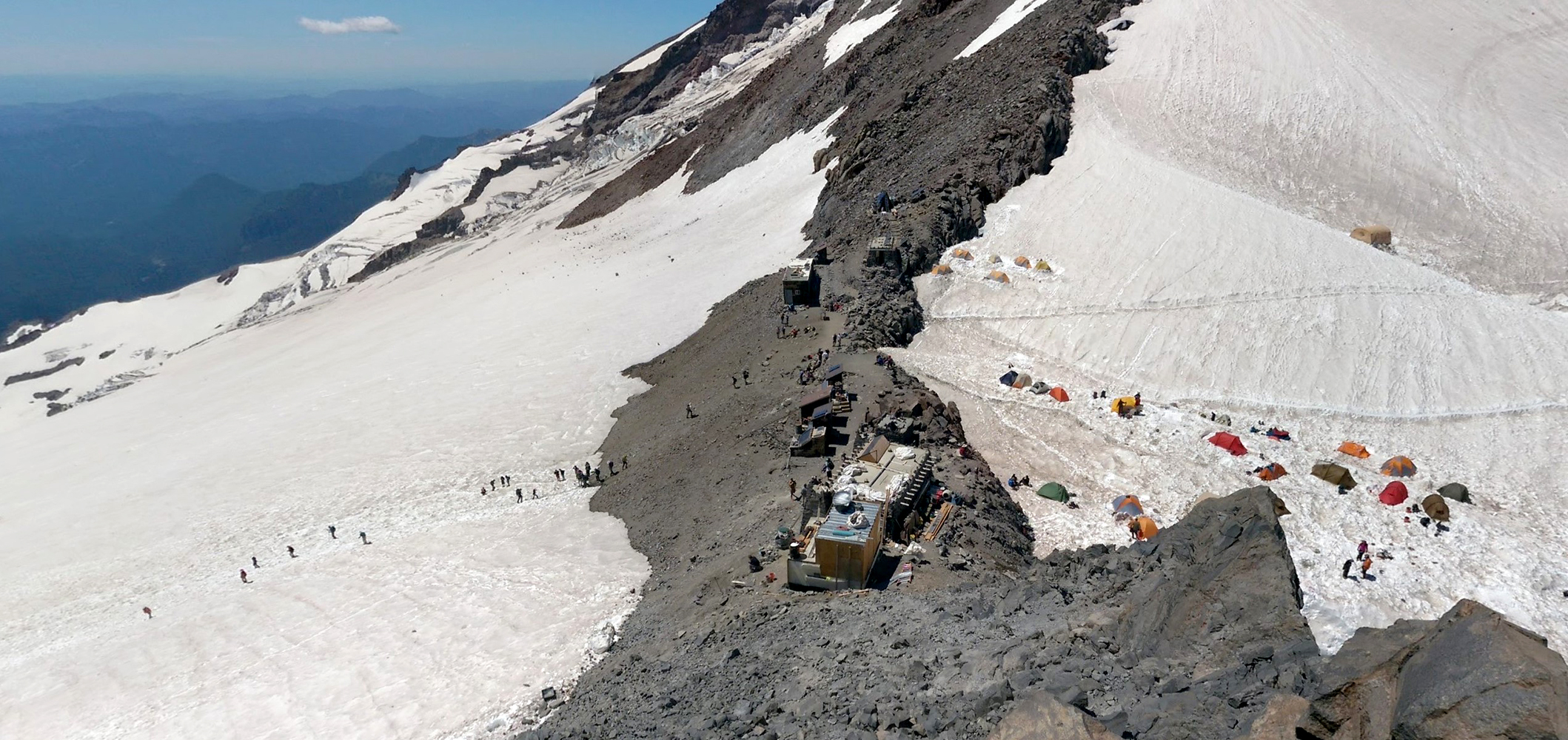
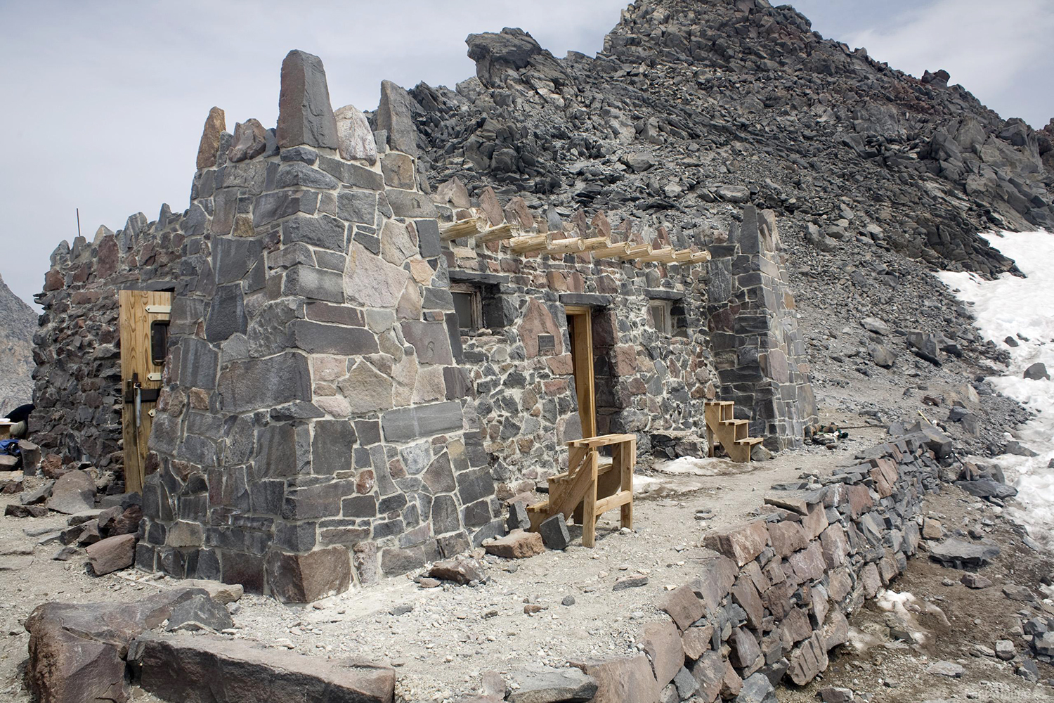
Camp Muir is one of two common basecamps used by climbers summiting the mountain. Muir is the higher of the two camps and the only one in your current line of sight. The other is on the NE side of the mountain and not easily visible from the PCT. Muir is also the higher camp at 10,050 ft. Day hiking the 4,689 ft from Paradise to Camp Muir is not uncommon and in spring one can glisade down much of the way.
To locate Camp Muir from your current vantage, look for the exposed rock wall on the south side of Little Tahoma. The camp is to the left of that, on the second major ridge over, about halfway between Little Tahoma and the left edge of the mountain.
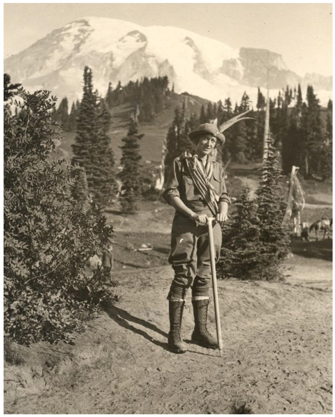
Alma Wagen
Alma Wagen was the first female mountain guide in the National Park system. Previously a math teacher in Tacoma, she was hired as a guide for the Rainier National Park Company in 1918 by Park Superintendent Dwitt L. Reaburn.
Four years earlier she developed a love of mountains when she visited Glacier National Park, ”I found my life’s work right in the National Parks. There were places to climb and I wanted to teach other women the joy of climbing.”
She was known as a proficient guide and strong climber. She had many notable ascents of Rainier, including a notable circumnavigation of the mountain above tree line, followed by an ascent via Emmons Glacier. Alma opened up career opportunities for women in the climbing world as a trailblazer for female climbing guides and rangers in national parks.
Women were prohibited from driving inside the park until only four years before Alma was hired.
Wonderland
Only 7.4 miles west of you hikers are on the Wonderland Trail walking Cowlitz Ridge. The original Wonderland Trail around Mt. Rainier was completed in 1915. It's original route was 140 miles and at lower elevations than today's 93 mile route. There is tremendous competition for the camping permits needed. Hikers may only camp at one of the 21 pre-established sites and the trail is heavily patroled by rangers.
Total elevation gain on the circular route is about 23,000 ft. The highest point on the trail is 6,766 ft. at Panhandle Gap between Little Tahoma and the Cowlitz Chimneys (roughly due west from Chinook Pass, but hidden behind the chimneys). Note that there are no transportation options (other than hitchhiking) for people wanting to do only sections of the Wonderland.

Fatalities
It's difficult to get exact numbers of the fatalaties that have occured in the park because the list keeps growing. Currently, 425 fatalities within the park have been recorded by the NPS. Over 100 of those deaths were climbers who died from falls or hypothermia. Some fatalities have occured below the basecamps due to white-out conditions. Others were engaging in backcountry snowsports at even lower elevations. Four fatalities were rangers who died from falls while rescuing climbers, and another ranger was the victim of a tragic shooting.
Approximately fifty unrecovered bodies are still on the mountain somewhere. That includes 32 US Marines killed in a 1946 plane crash, and 11 people swept to their deaths in a 1981 icefall.


Civilian Conservation Corps (CCC)
When I visit the park I appreciate the quality of some of the lasting work of the CCC such as the Christine Falls Bridge. President Roosevelt’s "New Deal" brought vast improvements to Mount Rainier. Between 1933-1940, over 1,000 men from the CCC came each summer to work on trail construction, campground improvement, and other construction. CCC companies consisted of groups of 18-25 year old men who worked for six month enrollment periods during the summer. During the 1930s there were six CCC camps in the park. Camps were a mixture of framed buildings and tents. All were wired for lighting and furnished with heater stoves.
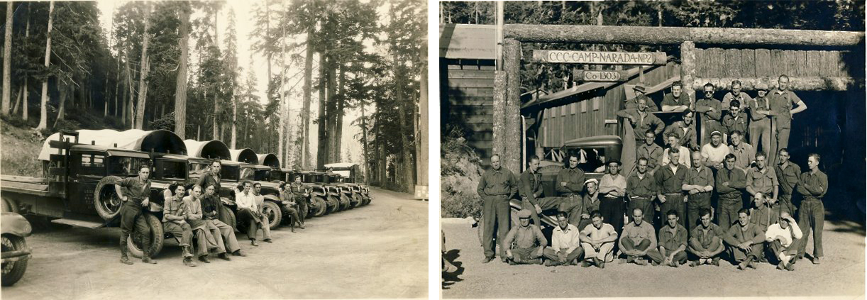
Funding and visitation plummeted during World War II, though the park did find new use as a training ground for the army’s mountain divisions.
"NPS rustic" The architectural style we've come to associate with National Parks debuted here in 1910-1920 (Longmire Inn) and became the standard for the NP system. Paradise Inn however is modeled after a European alpine resort, and the Ohanapecosh Visitor Center is in the mid-century "Mission 66" style later adopted by the NPS.
Road access
The first roads into the park were the road from the NE up the White River to Fryingpan Creek, the road from the west to the hot springs at Longmire, and the road from Packwood north to the Ohanapecosh hot springs.
The road to Paradise was completed in 1915. For 42 years Paradise could only be reached from the west.
The road from the White River to Sunrise (Yakima Park) was completed in 1931
The road to Mowich was completed in 1933 (the Fairfax bridge over the Carbon River completed in 1921, now showing "signs of advanced deterioration" has a much reduced weight limit)
On the east side, Cayuse Pass and Ohanapecosh were not connected until 1940.
The Stevens Canyon road connected Ohanapecosh with Paradise in 1957
Loved to death
Mt. Rainier was the first national park to allow personal vehicles to enter for a fee in 1907. Since then park administrators have struggled to keep up with the constant demand for more roads, lodging, and other services. In 2023 people entering the park totaled 2,523,376 arriving in about half as many vehicles. That volume caused paralyzing weekend traffic jams around the entire park and most visitors found no place to park.
To remedy the problems that peaked in 2023, starting May 1st 2024 the park implemented a Timed Entry Reservation system. This requires visitors to secure entry permits before entering the park with a vehicle. These permits are in addition to entry fee or park pass. Thru traffic on highway 123 does not need this permit.
