(mm 2387) You are standing on one of two primary horseback routes over the Cascades from the time the natives began using horses until the road over Snoqualmie Pass was built. The other route is Naches Pass south of here.
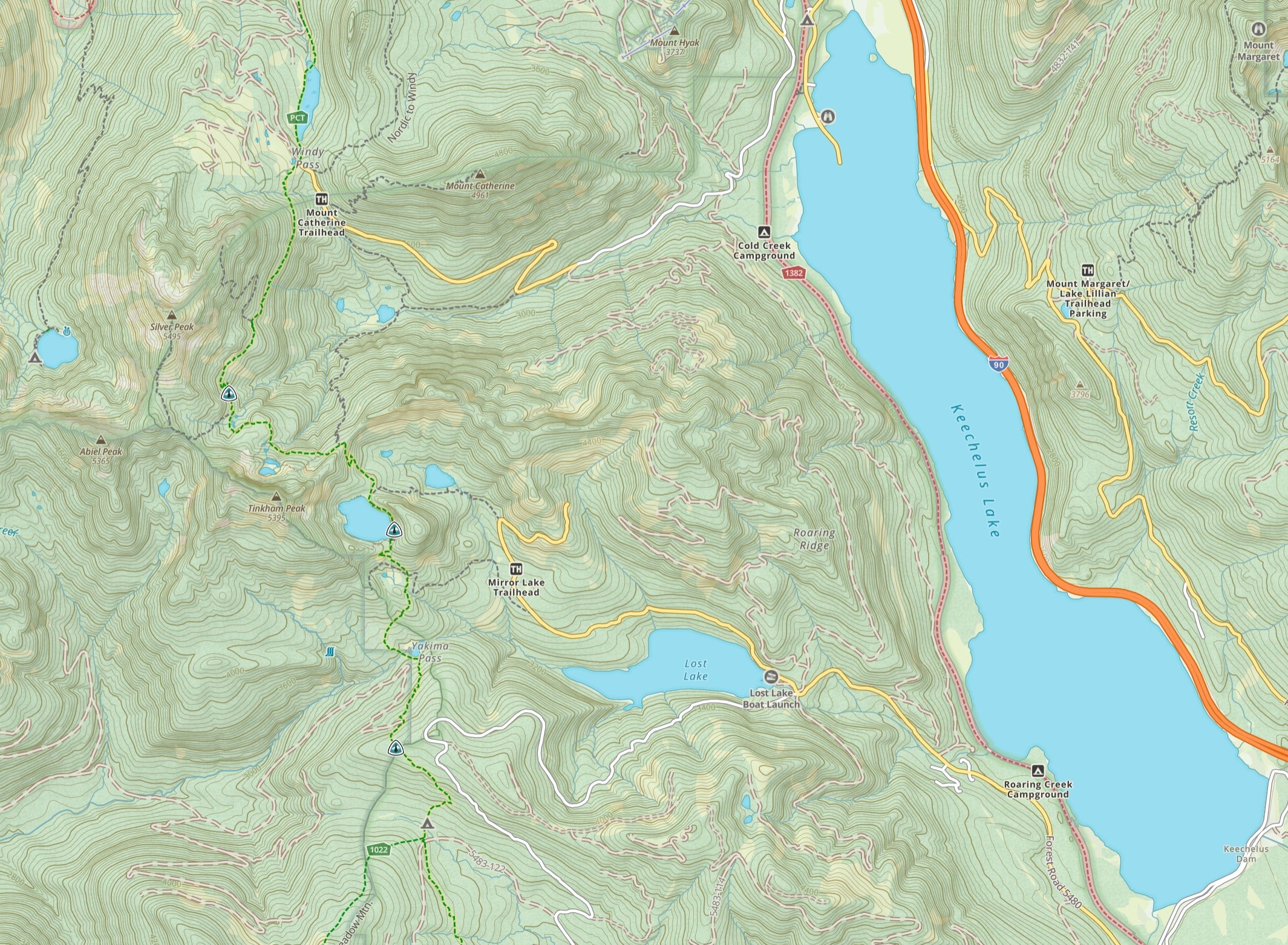
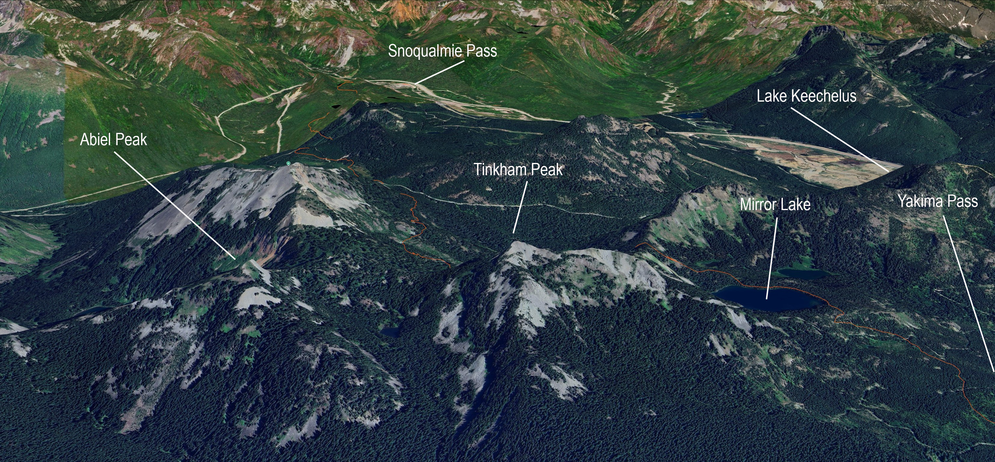
While Snoqualmie Pass, nine trail miles north of here, is the lower route, the natural topography of Keechelus Lake made it almost impassable for horses. It was used only as a foot route. The Yakima Pass route bypasses the impassible part of Keechelus Lake. Yakima Pass also has the advantage of following either the Cedar River or the Snoqualmie River on the west side of the crest.
The 3,596 ft. pass is named for the Yakima tribe that lived on the east side of the pass.
When I am hiking the PCT I make it a point to leave the trail at Yakima Pass and enjoy the scenic meadow.

1853 September
Captain George McClellan, US Army, was here on Wednesday September 7th, 1853. He and his company had come from Ellensburg and were guided here by Indians he met in Thorp. The air was hazy with smoke from a forest fire. They went over Yakima Pass and explored about three miles down the west side, deciding the route was too seep for a wagon road.
1854 January
Lieutenant Abiel Tinkham was here the following year on January 21st, 1854 with four native guides from Cle Elum. They snowshoed here in snow that was 6-7' deep.
Tinkam was here because he had recieved a letter at Fort Walla Walla from Governor Stevens who was unsatisfied with McClellan’s assessment. In the letter the Governor asked Tinkham to make a winter crossing of the Cascades via Lake Keechelus and personally evaluate the route to the South Fork Snoqualmie River. It's likely the Governor had heard local reports of Snoqualmie Pass and specifically asked for a January crossing of frozen Lake Keechelus so Tinkam could reach the north end of the lake. But Snoqualmie Pass continued to elude non-natives; Tinkam did snowshoe accross a frozen Keechelus Lake, but his guides took him west instead of continuing to the north end of the lake. They walked accross frozen Lost Lake, up to Yakima Pass, and down the Cedar River to what is now called Rattlesnake Lake. Just 6 days later they arrived in Seattle.

Tinkham Peak
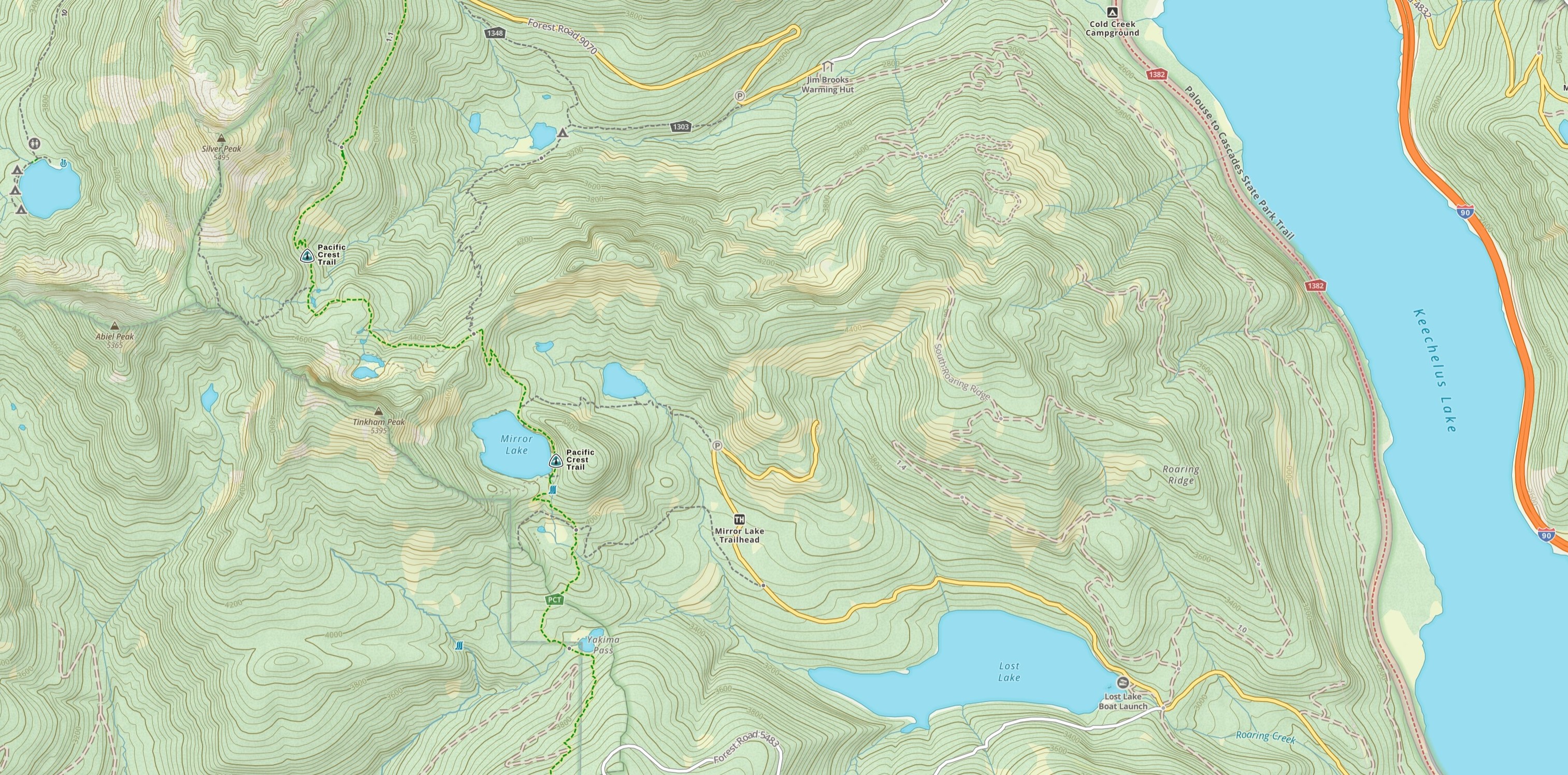
Two peaks and a road were named after Abiel Tinkham. One trail mile north of here is Mirror Lake. If you gaze up at the peak behind it, you will be looking at Tinkham Peak.
Hikers may choose to drop pack and scramble the 0.9 miles and 1,084 ft to the top via the SE ridge.
0.7 trail miles north of Mirror Lake is a side trail to Tinkham Tarns, one of my favorite places.
1.4 trail miles past Mirror Lake PCT hikers will encounter the ponds that mark the side trail to Abiel and Silver Peaks. Abiel Peak is due west from there.

