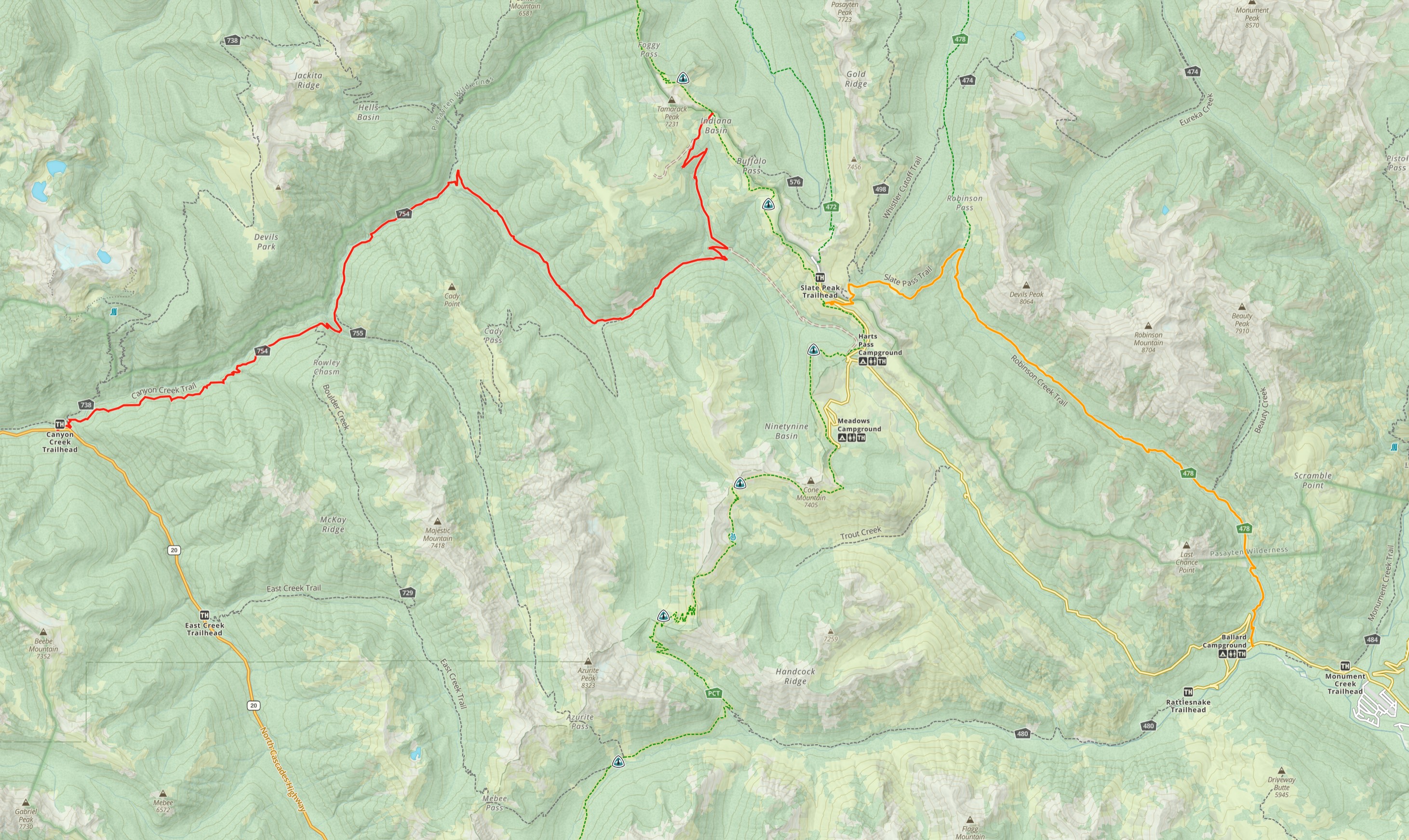
State Route 20 did not exist east of Diablo or west of Mazama until fall 1972. Prior to that it was a dirt road and hikers needed to walk that dirt road from what is today Bridge Creek Trailhead.
From there they could chose one of two routes. They could take the primary route and walk the road to the NW for 17.7 miles to the Canyon Creek Trailhead. From there they hiked up the Canyon Creek valley turing east up the Slate Creek Valley and connectiong with today's PCT at either Harts Pass or Windy Pass.
Or they could walk the road east up and over Washington Pass to Mazama. From there they could hitch a ride to Harts Pass or hike the Robinson Creek Trail north to connect with today's PCT at Slate Peak, just north of Harts Pass. The road to Harts Pass pre-dates the CCT.
Todays PCT route north from Rainy Pass over Cutthroat Pass and Methow Pass was built sometime between 1962 and 1995. I'm still trying to learn exactly when that was built.
The road to Harts Pass was built in 1893 as a narrow single-guage wagon road to access numerous gold and silver mines around the town of Barron in the Bonita Creek valley. In 1909 it became part of a state road built from Pateros to Harts Pass via Winthrop and Mazama, and was then widened and improved.
